
From the urban sprawl of Houston to the riverways of Virginia, air pollution from industrial plants is elevating the cancer risk of an estimated quarter of a million Americans to a level the federal government considers unacceptable.
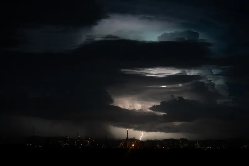
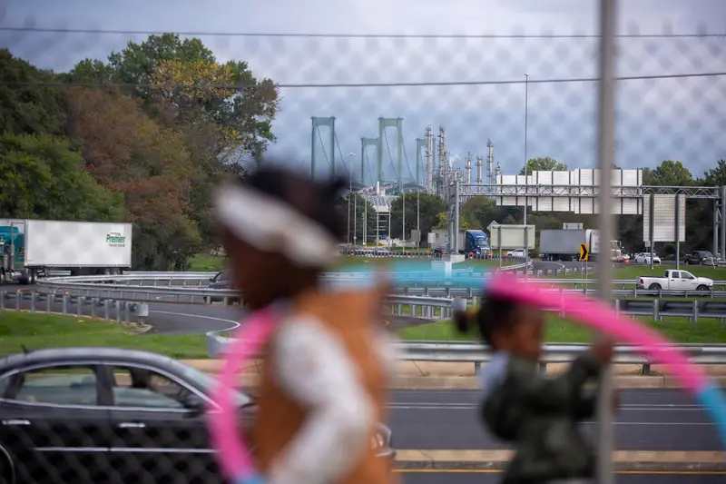
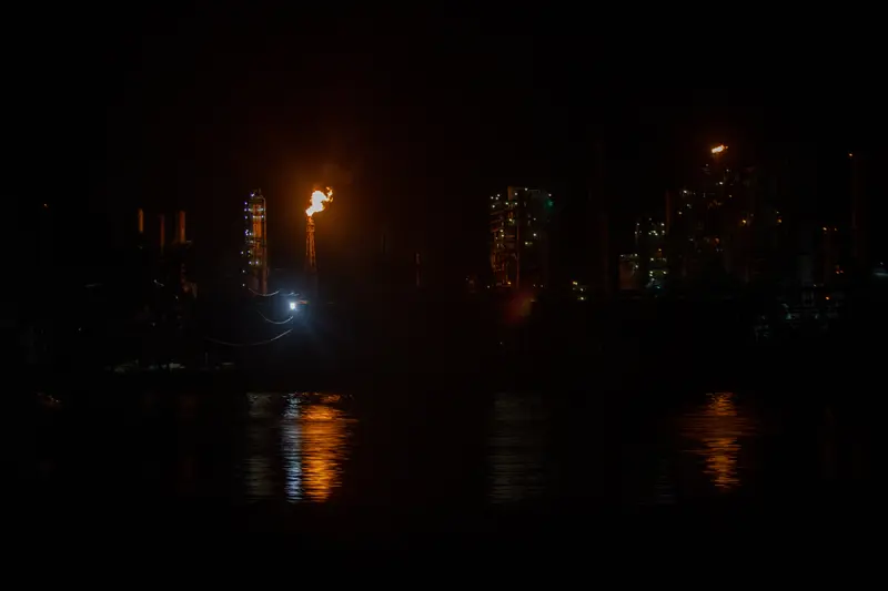
Some of these hot spots of toxic air are infamous. An 85-mile stretch of the Mississippi River in Louisiana that’s thronged with oil refineries and chemical plants has earned the nickname Cancer Alley. Many other such areas remain unknown, even to residents breathing in the contaminated air.
Until now.
ProPublica undertook an analysis that has never been done before. Using advanced data processing software and a modeling tool developed by the Environmental Protection Agency, we mapped the spread of cancer-causing chemicals from thousands of sources of hazardous air pollution across the country between 2014 and 2018. The result is an unparalleled view of how toxic air blooms around industrial facilities and spreads into nearby neighborhoods.
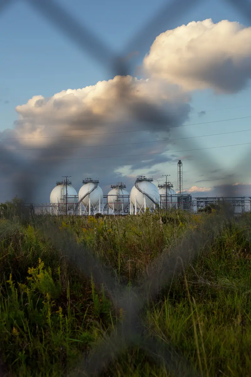
At the map’s intimate scale, it’s possible to see up close how a massive chemical plant near a high school in Port Neches, Texas, laces the air with benzene, an aromatic gas that can cause leukemia. Or how a manufacturing facility in New Castle, Delaware, for years blanketed a day care playground with ethylene oxide, a highly toxic chemical that can lead to lymphoma and breast cancer. Our analysis found that ethylene oxide is the biggest contributor to excess industrial cancer risk from air pollutants nationwide. Corporations across the United States, but especially in Texas and Louisiana, manufacture the colorless, odorless gas, which lingers in the air for months and is highly mutagenic, meaning it can alter DNA.
In all, ProPublica identified more than a thousand hot spots of cancer-causing air. They are not equally distributed across the country. A quarter of the 20 hot spots with the highest levels of excess risk are in Texas, and almost all of them are in Southern states known for having weaker environmental regulations. Census tracts where the majority of residents are people of color experience about 40% more cancer-causing industrial air pollution on average than tracts where the residents are mostly white. In predominantly Black census tracts, the estimated cancer risk from toxic air pollution is more than double that of majority-white tracts.
After reviewing ProPublica’s map, Wayne Davis, an environmental scientist formerly with the EPA’s Office of Chemical Safety and Pollution Prevention, said, “The public is going to learn that EPA allows a hell of a lot of pollution to occur that the public does not think is occurring.”
Our analysis comes at a critical juncture for the fate of America’s air. After decades of improvement, air quality has, by some metrics, begun to decline. In the last four years, the Trump administration rolled back more than a hundred environmental protections, including two dozen air pollution and emissions policies.
The EPA says it “strives to protect the greatest number of people possible” from an excess cancer risk worse than 1 in a million. That risk level means that if a million people in an area are continuously exposed to toxic air pollutants over a presumed lifetime of 70 years, there would likely be at least one case of cancer on top of those from other risks people already face. According to ProPublica’s analysis, 74 million Americans — more than a fifth of the population — are being exposed to estimated levels of risk higher than this.
EPA policy sets the upper limit of acceptable excess cancer risk at 1 in 10,000 — 100 times more than the EPA’s more aspirational goal and a level of exposure that numerous experts told ProPublica is too high. ProPublica found that an estimated 256,000 people are being exposed to risks beyond this threshold and that an estimated 43,000 people are being subjected to at least triple this level of risk. Still, the EPA sees crossing its risk threshold as more of a warning sign than a mandate for action: The law doesn’t require the agency to penalize polluters that, alone or in combination, raise the cancer risk in an area above the acceptable level.
In response to ProPublica’s findings, Joe Goffman, acting assistant administrator for the EPA’s Office of Air and Radiation, said in an emailed statement, “Toxic air emissions from industrial facilities are a problem that must be addressed.” Under President Joe Biden’s administration, “the EPA has reinvigorated its commitment to protect public health from toxic air emissions from industrial facilities — especially in communities that have already suffered disproportionately from air pollution and other environmental burdens.”
ProPublica’s reporting exposes flaws with EPA’s implementation of the Clean Air Act, a landmark law that dramatically reduced air pollution across America but provided less protection to those who live closest to industrial polluters.
The 1970 law resulted in outdoor air quality standards for a handful of widespread “criteria” pollutants, including sulfur dioxide and particulate matter, which could be traced to exhaust pipes and smokestacks all over the country and were proven to aggravate asthma and lead to early deaths. But 187 other dangerous chemicals, now known as hazardous air pollutants or air toxics, never got this level of attention. At the time, the science demonstrating the harms of these compounds, which primarily impact people in neighborhoods that border industrial facilities — so-called fence line communities — was still in its early stages. The EPA did not receive enough funding to set the same strict limits, and industry lobbying weakened the agency’s emerging regulations.
In 1990, Congress settled on a different approach to regulating air toxics. Since then, the EPA has made companies install equipment to reduce their pollution and studied the remaining emissions to see if they pose an unacceptable health risk.
The way the agency assesses this risk vastly underestimates residents’ exposure, according to our analysis. Instead of looking at how cancer risk adds up when polluters are clustered together in a neighborhood, the EPA examines certain types of facilities and equipment in isolation. When the agency studies refineries, for example, it ignores a community’s exposure to pollution from nearby metal foundries or shipyards.
Matthew Tejada, director of the EPA’s Office of Environmental Justice, told ProPublica that tackling hot spots of toxic air will require “working back through 50 years of environmental regulation in the United States, and unpacking and untying a whole series of knots.”
“The environmental regulatory system wasn’t set up to deal with these things,” he said. “All of the parts of the system have to be re-thought to address hot spots or places where we know there’s a disproportionate burden.”
The Clean Air Act rarely requires industry or the EPA to monitor for air toxics, leaving residents near these plants chronically uninformed about what they’re breathing in. And when companies report their emissions to the EPA, they’re allowed to estimate them using flawed formulas and monitoring methods.
“These fence line communities are sacrifice zones,” said Jane Williams, executive director of California Communities Against Toxics. “Before there was climate denial, there was cancer denial. We release millions of pounds of carcinogens into our air, water and food and act mystified when people start getting sick.”
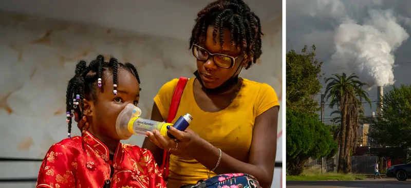
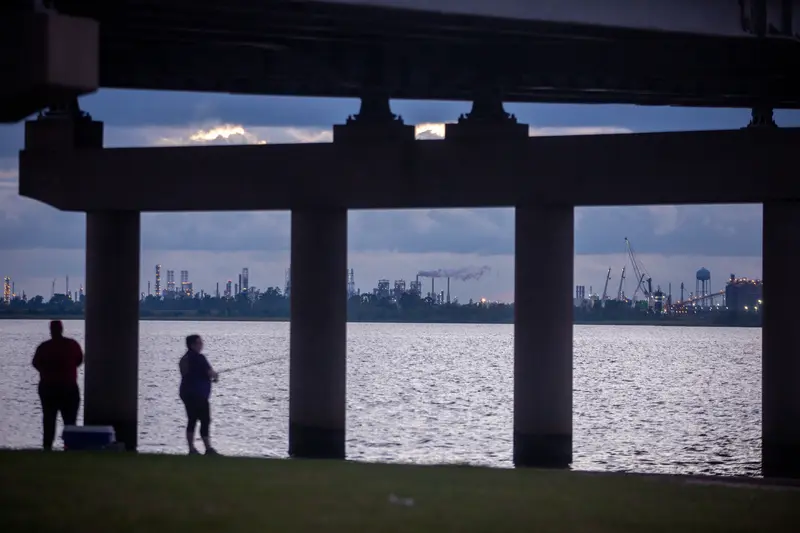
Brittany Madison is worried about the air. Madison, who is 31, lives in Baytown, Texas, a city next to the Houston ship channel where the skyline is dense with the glittering towers of chemical plants. In the apartment she shares with her 7-year-old son, her 39-year-old sister and her nieces and nephew, the low, steady hum of air purifiers is unremitting. Her 3-year-old niece, K’ryah, has suffered from debilitating asthma attacks since she was born. Even on good days, the family tries to keep K’ryah indoors as much as possible. On bad days, they shut the windows. And about once a month, they rush her to the hospital, where she’s given oxygen and injected with steroids.
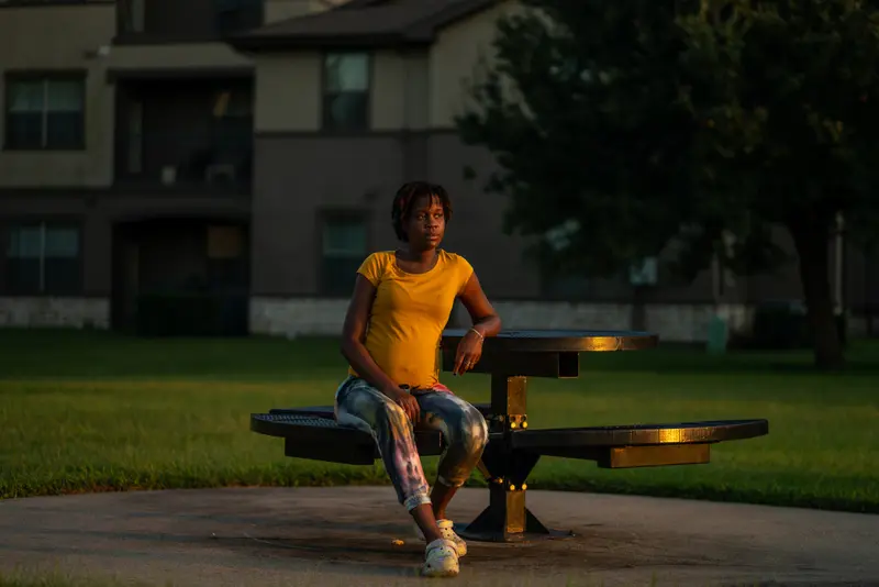
Madison, who’s six months pregnant, loves taking long walks and watching the kids at the playground, but lately she’s been spending more and more time inside. Her home lies a few miles north of ExxonMobil Baytown Complex, one of the largest refineries in the world. Over the years, Exxon’s massive petrochemical operation has sent millions of pounds of toxic chemicals into the sky during accidents, unplanned discharges and fires. (ExxonMobil did not respond to requests for comment.) After a particularly smoky fire in 2019, Madison came down with a migraine, her first. Her son, who didn’t know the word for headache, told her that his brain was hurting.
Madison began to wonder if living near all these pipes and tanks and towers had something to do with the health conditions that afflicted her neighborhood. Air toxics are associated with a host of adverse effects that range from headaches and nausea to lung damage, heart failure and death, and they’re especially hazardous for kids and the unborn. A study by the University of Texas School of Public Health found that children living within 2 miles of the Houston ship channel had a higher risk of developing acute lymphocytic leukemia. Madison’s father, who worked at several nearby plants, died from a heart attack at 43. Friends and family have died of cancer. “You wonder what causes it. Is it the air we breathe? Or the food?” Madison asked. “There are just all these different questions that no one has answers to.”
The cancer risks from industrial pollution can be compounded by factors like age, diet, genetic predisposition and exposure to radiation; the knock-on effect of inhaling toxic air for decades might, for example, mean the difference between merely having a family history of breast cancer and actually developing the disease yourself. While the cancer and asthma rates in Houston’s Harris County are comparable with those in the rest of the state, Texas officials have identified cancer clusters in several of the city’s neighborhoods.
Large swaths of the Greater Houston area make up the third-biggest hot spot of cancer-causing air in the country, according to our analysis, after Louisiana’s Cancer Alley and an area around Port Arthur, Texas, which is on the Louisiana border. For many homes closest to the fence lines of petrochemical plants in cities like La Porte and Port Neches, Texas, the estimated excess risk of cancer ranges from three to six times the level that the EPA considers acceptable.
But because of the way that the EPA underestimates risk, the true dangers of living in a toxic hot spot are often invisible to regulators and residents.
The agency breaks things down into the smallest possible categories “to avoid addressing what we call cumulative risk,” said John Walke, an attorney at the Natural Resources Defense Council who formerly worked as an EPA lawyer advising the Office of Air and Radiation. “But our bodies do not parse out air pollution according to rule labels or industrial equipment or industrial source categories.” The cancer risk from each facility or type of equipment may be at levels the agency considers “acceptable,” but taken together, the potential harms can be substantial.
The EPA initially sent ProPublica a statement saying that it “ensures that risks from individual source categories are acceptable and that the standards provide an ample margin of safety to protect public health.”
In another statement sent after an interview, the agency added, “We understand that communities often confront multiple sources of toxic air pollution and face cumulative risks greater than the risk from a single source.” The EPA added that it was working both to better harness the science on cumulative risks and “to better understand risks for communities who are overburdened by numerous sources of multiple pollutants.”
Madison can’t help but notice that when her family travels, K’ryah’s asthma improves. “The first chance I get, I’m moving far away from Texas and never looking back,” she said. “I love being outside. I love seeing the stars. I don’t want to feel like someone is pumping gas onto our front porch.”

The locations of the hot spots identified by ProPublica are anything but random. Industrial giants tend to favor areas that confer strategic advantages: On the Gulf Coast, for instance, oil rigs abound, so it’s more convenient to build refineries along the shoreline. Corporations also favor places where land is cheap and regulations are few.
Under federal law, the EPA delegates the majority of its enforcement powers to state and local authorities, which means that the environmental protections afforded to Americans vary widely between states. Texas, which is home to some of the largest hot spots in the nation, has notoriously lax regulations.
Between 2008 and 2018, lawmakers cut funding for state pollution-control programs by 35% while boosting the state’s overall budget by 41%, according to a report by the Environmental Integrity Project, an advocacy group founded by former EPA staffers. A Texas Tribune story from 2017 found that during the prior year, the Texas Commission on Environmental Quality had levied fines in fewer than 1% of the cases in which polluters exceeded emission limits. Even when penalties are issued, many polluters see these fines as part of the cost of doing business, said Craig Johnston, a former lawyer at the EPA and a professor of environmental law at Lewis and Clark Law School.
Gary Rasp, a TCEQ spokesperson, told ProPublica that the agency “has taken actions to monitor, mitigate, and improve the air quality in fence line communities.” The agency runs dozens of stationary air toxics monitors across the state, he added, and “by continuously evaluating air monitoring data, which is more accurate than modeling, TCEQ can identify issues.” The agency also inspects industrial facilities and “has an active enforcement program, referring particularly egregious cases to the Texas Office of the Attorney General.”
That the people living inside these hot spots are disproportionately Black is not a coincidence. Our findings build on decades of evidence demonstrating that pollution is segregated: People of color are exposed to far greater levels of air pollution than whites — a pattern that persists across income levels. These disparities are rooted in racist real estate practices like redlining and the designation of low-income neighborhoods and communities of color as mixed residential-industrial zones. In cities like Houston, for example, all-white zoning boards targeted Black neighborhoods for the siting of noxious facilities, like landfills, incinerators and garbage dumps. Robert Bullard, a professor of urban planning and environmental policy at Texas Southern University, has called the practice “PIBBY” or “Place In Blacks’ Back Yard” — a spin on the acronym “NIMBY” (“Not In My Back Yard”).
Many of the neighborhoods that border chemical plants are low-income and lack the same resources, access to health care and political capital that wealthier neighborhoods can bring to fights against intrusive commercial activities. In places like Baytown, working-class people depend on the very companies that sicken them to earn a living. Over the years, the shadow of industry can permanently impair not just a neighborhood’s health but also its economic prospects and property values, fueling a cycle of disinvestment. “Industries rely on having these sinks — these sacrifice zones — for polluting,” said Ana Baptista, an environmental policy professor at The New School. “That political calculus has kept in place a regulatory system that allows for the continued concentration of industry. We sacrifice these low-income, African American, Indigenous communities for the economic benefit of the region or state or country.”
Tejada, the EPA’s director of environmental justice, said that the Biden administration and the EPA are focused on confronting these disparities. “These places didn’t happen by accident. The disproportionality of the impacts that they face, the generations of disinvestment and lack of access are not coincidences. These places were created. And it is the responsibility of everyone, including the government — chiefly the government — to do something about it.”
The federal government has long had the information it would need to take on these hot spots. The EPA collects emissions data from more than 20,000 industrial facilities across the country and has even developed its own state-of-the-art tool — the Risk-Screening Environmental Indicators model — to estimate the impact of toxic emissions on human health. The model, known as RSEI, was designed to help regulators and lawmakers pinpoint where to target further air-monitoring efforts, data-quality inspections or, if necessary, enforcement actions. Researchers and journalists have used this model for various investigations over the years, including this one.
And yet the agency’s own use of its powerful modeling tool has been limited. There’s been a lack of funding for and a dearth of interest in RSEI’s more ambitious applications, according to several former and current EPA employees. Wayne Davis, the former EPA scientist, managed the RSEI program under the Trump administration. He said that some of his supervisors were hesitant about publishing information that would directly implicate a facility. “They always told us, ‘Don’t make a big deal of it, don’t market it, and hopefully you’ll continue to get funding next year.’ They didn’t want to make anything public that would raise questions about why the EPA hadn’t done anything to regulate that facility.”
Nicolaas Bouwes, a former senior analyst at the EPA and a chief architect of the RSEI model, recalled the occasional battle to get colleagues to accept the screening tool, let alone share its findings with the public. “There’s often been pushback from having this rich data sheet too readily available because it could make headlines,” he said. “What I find annoying is that the EPA has the same information at their disposal and they don’t use it. If ProPublica can do this, so can the EPA.”
In its statement, the EPA said that it plans to improve its approach for sharing air toxics data faster and more regularly with the public. “EPA has not published calculated cancer risks using RSEI modeled results,” it continued. “RSEI results are not designed as a substitute for more comprehensive, inclusive, or site specific risk assessments,” but as a potential starting point that should only be used “to identify situations of potential concern that may warrant further investigation.”
Indeed, our map works as a screening tool, not as a site-specific risk assessment. It cannot be used to tie individual cancer cases to emissions from specific industrial facilities, but it can be used to diagnose what the EPA calls “situations of potential concern.”
Our analysis arrives as America faces new threats to its air quality. The downstream effects of climate change, like warmer temperatures and massive wildfires, have created more smoke and smog. The Trump administration diluted, scuttled or reversed dozens of air pollution protections — actions estimated to lead to thousands of additional premature deaths. In 2018, then-EPA Administrator Scott Pruitt created a massive air toxics loophole when he rolled back a key provision of the Clean Air Act, known as “Once In, Always In,” allowing thousands of large polluters to relax their use of pollution-controlling equipment.
Biden has yet to close this loophole, but he has signaled plans to alleviate the disproportionate impacts borne by the people who live in these hot spots. Within his first few days in office, he established two White House councils to address environmental injustice. And in March, Congress confirmed his appointment of EPA administrator Michael Regan, who has directed the agency to strengthen its enforcement of violations “in communities overburdened by pollution.”
The White House did not respond to a request for comment.
Environmental advocates say that the Biden administration should lean on the EPA to test the air in toxic hot spots and take action against polluters who are violating their permits. It should also push for new rules that take into account the much greater risks posed when multiple facilities are grouped together in an area. Advocates also say the EPA should reexamine its tolerance of 1 in 10,000 as an acceptable excess cancer risk and extend the limit of 1 in 1 million to all, given how much the knowledge and technology surrounding air toxics has advanced since the 1980s. “We recognize that what was acceptable then is not OK now,” said Emma Cheuse, an attorney and air toxics expert at the advocacy group Earthjustice.
The EPA adopted the 1 in 10,000 threshold based on a 1988 agency report that listed the probability of dying from unusual things like “ignition of clothing,” “venomous plants” or drowning and then choosing a risk level roughly in the middle of the range. EPA’s decision was “essentially arbitrary,” said Patricia Ross McCubbin, a professor of environmental law at Southern Illinois University who’s researched the agency’s risk program.
Tejada said that the potential reevaluation of the EPA’s acceptable risk limit was “a big-time policy question.”
“We want to see progress” on hot spots, Tejada added, but given the complexity of the problems, he warned that progress could take time. “We’re not going to lie to anybody and say, ‘Well, by the end of this administration, everyone’s going to be fine.’ I don’t think anybody would buy that.”
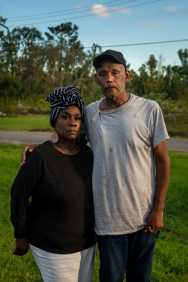
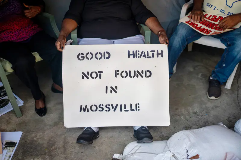
Without stronger protections, many of the people living in fence line communities worry about becoming collateral damage. For residents of Mossville, Louisiana, it is already too late.
Among the most polluted pockets of the country, the community in southwest Louisiana has all but disappeared amid the steady encroachment of the South African chemical giant Sasol. The company’s most recent construction led to a buyout of more than half of the area's remaining residents. In the late 1990s, more than 500 people lived in Mossville. Residents say only 50 or so remain.
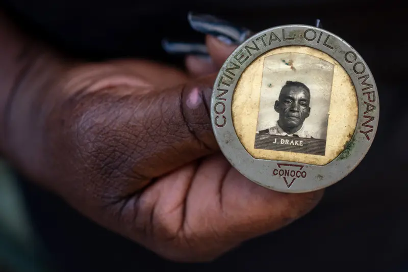
Mossville was founded by formerly enslaved people in the 1790s, long before the Civil War. Debra Sullivan Ramirez, 67, remembers her childhood there as a kind of idyll. She and her family lived off the land, with its shady swamps and leafy orchards. They grew their own fruits and vegetables, hunted and fished, and strained juice from Mayhaw trees to make jelly. After church on Sundays, Sullivan Ramirez remembers, she would fall asleep on her grandma’s front porch to the soothing hum of the Conoco chemical plant across the street.
In hindsight, there had always been warning signs. Fluorescent ponds. Plumes of yellow smoke. The occasional explosion in the sky. Not to mention all the sickness. Many of her neighbors suffered from respiratory problems and heart disease. Her father had diabetes, which may have been triggered by dioxin, a chemical that attacks the pancreas. Her sister Sandra died of ovarian cancer at 61. Her neighbor Kathy Jones died at 58 from an 8-pound tumor near her kidney.
“It wasn’t one block that didn’t have cancer,” Sullivan Ramirez said.
Over the years, Sullivan Ramirez herself has struggled with nerve degeneration and scleroderma, a rare condition that involves the tightening of the skin and connective tissues. While it can be difficult to link specific cases of disease to pollution exposure, the evidence in Mossville has accumulated: In a 1998 health survey conducted by the University of Texas, 84% of Mossville residents reported having headaches, dizziness, tremors and seizures. An EPA study from the same year found that the average level of dioxins in the blood of Mossville residents was dangerously high — triple that of the general U.S. population. Even small amounts of dioxin, one of the most poisonous chemicals released by facilities, can cause developmental problems, damage the immune system and lead to cancer. A 2007 report found that the types of dioxin compounds in the blood of Mossville residents matched those emitted by local industrial facilities.
In an emailed statement, Sasol noted that its property buyout stemmed from direct requests from Mossville residents and that the company offered owners more than the appraised value of their homes. “Sasol and its predecessor have produced or handled chemicals at our Lake Charles complex for more than 60 years. We understand the science and have controls in place to ensure our operations are safe, protective of the environment, compliant with regulations and sustainable over the long term,” wrote Sarah Hughes, a spokesperson for Sasol. “Sasol is proud of our engagement with our neighbors in Mossville and the positive impact it has had on many of its residents.”
Sullivan Ramirez is wary of too much talk. She knows that the new administration has promised something more for communities like hers, but she doesn’t want to get her hopes up. The presentations from captains of industry, the listening sessions with earnest bureaucrats, the proposals from slick attorneys, the promises tossed off by politicians — over the years, she’s heard it all.
The people of Mossville are right to be skeptical, the EPA’s Tejada acknowledged. “I would be skeptical if I was from Mossville,” he added. “They should be skeptical until we actually show up and do the things that they’ve been asking us to do for a long time. But there’s now a level of commitment to actually tangling with these issues in a really serious, substantive way.”
After years of activism in Mossville, Sullivan Ramirez moved to Lake Charles, just a short drive away. But she worries the industrial sprawl will one day overtake her new home. To Sullivan Ramirez, Mossville is “the key” — a warning of what the future holds for America’s other hot spots if business continues as usual.
“This is the 21st century,” she said. “The act of polluting our lands and robbing our communities — when will enough be enough?”

Reporting was contributed by Jeff Kao, Alyssa Johnson, Kiah Collier and Max Blau of ProPublica, and by Kathleen Flynn. Graphics by Lucas Waldron of ProPublica.


